Are you looking for a raw natural beauty with immersive and real-world adventure that can crave your travel thirst? We have compiled the list of the best hiking trails in the world that takes you through jaw-dropping landscapes and rich culture.
Whether you like the snow-capped routes or the barren deserts, these trails promise you adventure at every step. From the lap of Mount Everest to the scenery of Machu Picchu, we are obliged to make your unforgettable moments count.
The following hiking trails are suited for both expert and intermediate hikers. Whether you are a beginner with less experience or an experienced hiker with prior trekking knowledge, these hiking routes cater for your preferences, interests, and physical benchmarks.
No matter what you are looking out, these destinations are best for solo hike, group hike, and family tours, that create story and memory that lasts for your lifetime.
Best Hiking Trails in Asia
Everest Base Camp – Nepal
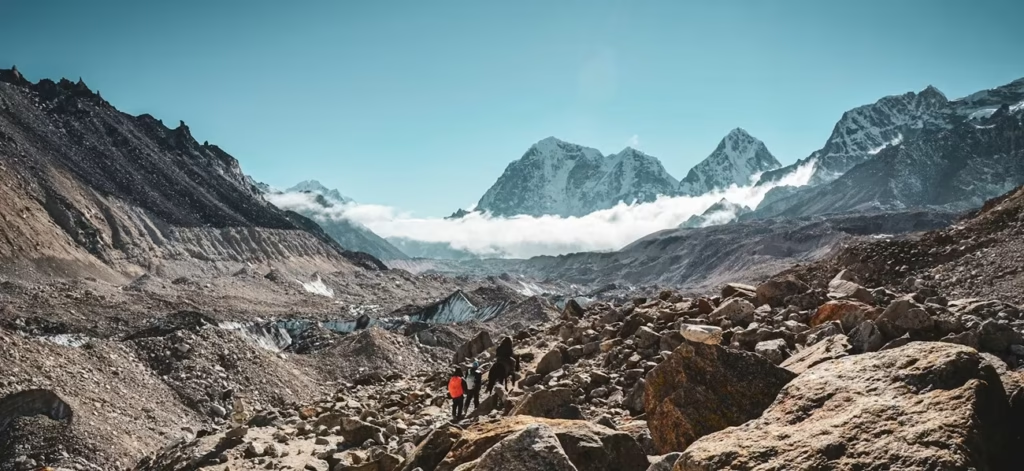
| Location | Everest Region, Nepal |
| Altitude | 5,364 m |
| Level | Challenging |
| Distance | 68 miles/110km |
| Duration | 11-12 days |
Everest Base Camp is the world’s premium destination for trekkers and travel enthusiasts. Sitting at an altitude of 5,364 meters above sea level, this destination gives you the real thrill of the Himalayan adventures.
The EBC Trek is undoubtedly one of the best hiking trails in the world. This is because it opens its way to give you the full thrill of remote landscape, exquisite Sherpa lifestyle, and Buddhist culture.
Some of the major attractions of the Everest Base Camp Trek are the Sir Edmund Hillary Suspension Bridge, Gorakshep, Namche Bazaar, and Tengboche Monastery.
The trek starts in Lukla after a 45-minute-long flight from Kathmandu. The beautiful remote trail then meanders through several Sherpa Villages such as Phakding, Namche Bazaar, Lobuche, and Dingboche before you step into the lap of the world’s highest mountain, Mt. Everest.
This trek also offers you panoramic views of mountains such as:
- Mt. Everest (8,848 meters/29,029 feet)
- Lhotse (27,940 feet / 8,516 meters)
- Nuptse (25,771 feet/ 7,855 meters)
- Ama Dablam (22,349 feet/ 6,812 meters)
- Kangtega (22,251 feet/6,782 meters)
- Thamserku (21,719 feet/6,623 meters)
If you want full guide to Everest Base Camp Trek, then please read the full blog here: Everest Himalaya Base Camp Trek
Annapurna Base Camp Trek – Nepal
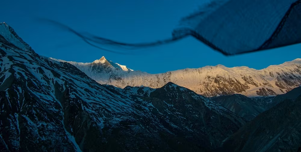
| Location | Annapurna Region, Nepal |
| Altitude | 4,130 m |
| Level | Moderate |
| Distance | 68 miles/110km |
| Duration | 10-12 days |
Annapurna Base Camp Trek in Nepal is another of the best hiking trails in the world. And it has its reasons for that. The very first thing is the beautiful Annapurna Base Camp itself.
Other attractions include Machhapuchhre Base Camp and the view of Dhaulagiri, Hiunchuli, Gangapurna and Annapurna I and II. The base camp lies within the protected area of Annapurna Conservation Area. It is home to various flora and fauna that support ecological balance in the region.
Another thing that travellers can enjoy is the unique culture among the Gurung settlements. The hospitable environment with traditional customs and local cuisine are some of the other factors making it the best hiking trails in the world.
The ABC Trek starts from Pokhara, passing through some of the renowned places like Ghandruk, Poon Hill, Jhinu Danda, and Machhapuchhre Base Camp.
Jordan Trail – Jordan
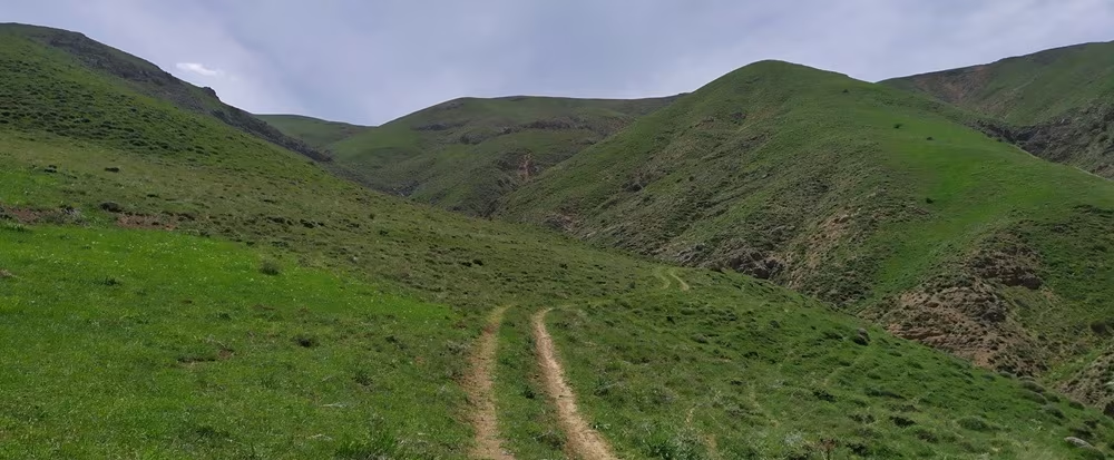
| Location | Jordan |
| Altitude | 1,730 m |
| Level | Challenging |
| Distance | 419 miles/675 km |
| Duration | 35 – 45 days |
One of the best hiking trails in the world that you should not be missing is the Jordan Trail. This trail spans 420 meters, starting from UMM Qais to Aqaba. Within the course of this great destination, travelers will explore their journey from north to south, passing through the capital city Amman.
Also, this trail covers the historic city of Petra, rich in traditional culture and lifestyle. In addition, travellers can also experience their adventure through the red sand desert of Wadi Rum, giving an entirely new experience.
Since the Jordan Trail is a multi-day hike, requiring around 35 to 45 days of itinerary, it might not be suitable for family travels. But you can explore the most popular section, which is 74 miles long (120 km), passing through remote ‘Wadis,’ and ‘Bedouin Villages.’
The trail runs between Wadi Rum and Petra, so you will have enough opportunities to explore Jordan’s history and culture as well. The trek is physically challenging, requiring some prior trekking experiences.
Kumano Kodo Trail – Japan
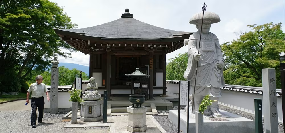
| Location | Everest Region, Nepal |
| Altitude | 868 m (2,847 ft) |
| Level | Moderate |
| Distance | 42 miles/68km |
| Duration | 3-5 days |
Japan, a country full of culture and technology, is home to some of the best hiking trails in the world. And among them, the Kumano Kodo Trail is one, which stands out as a network of trails in Japan. It cumulates the Kansai region, which links three major religious shrines: Hongu Taisha, Hayatama Taisha and Nachi Taisha).
The Kumano Kodo Trail has religious significance. In Japan, the word “Kodo” means old ways, and since the routes have been the very path for pilgrims for centuries, it carries a vast essence.
One of the famous trail sections is Nakechi, which begins in Takijiri Ōji. This trail section passes through the mountains taking travelers towards the grand shrines of the region. Standing out as the “Imperial Route,” it simply reflects the history of the Imperial Family using this trail from the 10th century.
The trek to the Kumano Kodo starts with an ascent to the Sakura-toge Pass. It takes adventurers towards the pine and cedar forests and Hyakken-gura Peak. Here, you can have cinematic views of Wakayama’s mountain peaks.
The trail then descends towards Koguchi village and then climbs to Funami-toge Pass. In this phase of the trek, travellers can enjoy the views of the Pacific Ocean and Katsuura Fishing Village. On the final leg of this journey, the trail goes down to Kumano Nachi Taisha, concluding the trek.
Best Hiking Trails in Europe
Laugavegur Trail, Iceland

| Location | Iceland |
| Altitude | 1,100m (3,609 ft) |
| Level | Challenging |
| Distance | 34 miles (54.7km) |
| Duration | 3-5 days |
If you are looking for multi-day adventures, the Laugavegur Trail in Iceland is the best hiking trail in the world that you should look at. It is a 55 km long trail that takes travelers through diverse landscapes and offers panoramic views.
The trek to the Laugavegur Trail starts from Landmannalaugar, and it takes around 3 to 5 days to complete, ending at Þórsmörk. Hikers explore major attractions of this region, including rhyolite mountains, glacial valleys, and black lava fields.
The trail features steep ascents and river crossing, which can be a lookout for many adventurers. The local tea houses and shops around the trail cover the logistics and accommodation facilities. However, during the peak seasons from late June to mid-September, reservations have to be made in advance.
Some of the major attractions of this trail include the panoramic views of Jökultungur and glaciers like Mýrdalsjökull. You can also take on an optional/additional hike through the Fimmvörðuháls pass, which leads to Skógar. Hikers can enjoy the scenery of volcanic landscapes and waterfalls during this journey.
You can reach the trailhead either by bus or guided tour from Reykjavik. So, plan your itinerary accordingly to make the most out of it.
Saxer Lücke Hiking Trail – Switzerland
| Location | Switzerland |
| Altitude | 1,822 meters |
| Level | Moderate |
| Distance | 17.5 km |
| Duration | 5-7 Hours |
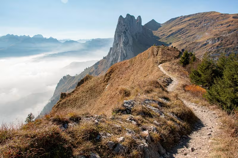
The Saxer Lücke Hike is another scenic hiking trail on the planet. It lies in Switzerland in the most scenic landscapes of the Alpstein region. This is a popular hiking trail for a reason: it offers hikers views of limestone peaks, Fälensee, the Rhine Valley, and lush alpine meadows.
The Saxer Lücke Hike starts with a cable car ride from Brülisau. It goes through Hoher Kasten or Frümsen to Staubern, but it all depends on the route you choose.
If you choose the trail from Hoher Kasten, it covers a 17.5 km loop passing through landmarks such as Staubern, Saxer Lücke, Fälensee, and Sämtisersee. The hike ends with a gradual descent to Brülisau. On average, it takes around 6 to 7 hours to complete the hike.
Another trail you can choose is the out-and-back trail to Saxer Lücke. This trail is around 6 km and takes 2 hours to complete the hike. This trail also offers great views of mountain trails with white-red-white blazes, rocky terrains, and metal steps.
The best times to travel to Saxer Lücke are from May to mid-November. During this timeframe, the trails remain snow-free, making it easier for navigation. However, it is essential to carry proper trekking gear for ease and safety.
Kungsleden (King’s Trail) – Sweden
| Location | Sweden |
| Altitude | 1,150 m |
| Level | Moderate |
| Distance | 467 kilometers |
| Duration | 4 weeks |
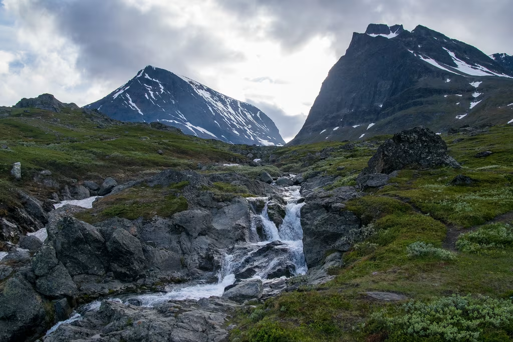
The Kungsleden, or King’s Trail, is undoubtedly one of the most beautiful hiking trails in the world. This trail stretches from Abisko to Hemavan and covers 467 kilometers in northern Sweden. This trail was established back in the early 20th century by the Swedish Tourist Association (STF).
This trail takes you through diverse terrains ranging from alpine landscapes to birch forests and valleys. This route has five sections; each of them can be chosen to suit the hiker’s preferences and time constraints.
The accommodation services are quite easy to find as numerous tea houses operate in this region. These facilities come with basic amenities like beds with mattresses, pillows, and blankets. Also, they feature communal kitchens and some of them even have small shops stocking essential supplies.
One of the major things to consider is that there are no tea houses or huts between Kvikkjokk and Ammarnäs. So camping might only be an option – it is essential to plan accordingly before you travel.
The best time to travel to the Kungsleden, aka King’s Trail, is from mid-June to early September. The weather in these months is calm and moldy, with longer daylight hours. But there can be sudden weather changes in this region, so hikers should be prepared with trekking gear.
Cinque Terre aka Blue Trail – Italy

| Location | Italy |
| Altitude | 200 metres |
| Level | Easy |
| Distance | 1.5 km |
| Duration | 30 minutes |
Another great hiking trail in Europe is the Blue Trail (Sentiero Azzurro) in Cinque Terre. It connects all five villages: Riomaggiore, Manarola, Corniglia, Vernazza, and Monterosso al Mare in Italy.
The Blue Trail covers a 12-kilometer (7.5 miles) route and gives you breathtaking views of the sea, terraced vineyards, and cliffside towns.
This beautiful trail in Italy has four major sections. The easiest one is the stretch from Riomaggiore to Manarola, known as Via dell’Amore, which is just 900 meters long. It is also disability friendly. The second section is from Manarola to Corniglia, but it is closed as of now due to landslide damage. It is expected to reopen in 2026.
The third section is from Corniglia to Vernazza, and it is 3.2 kilometers long. This section traverses through olive groves and forests, offering panoramic coastal views. The difficulty level of this stretch is moderately challenging.
The final section is from Vernazza to Monterosso, and it spans 3.3 kilometers. This trail features steep stairs and narrow trails and also offers stunning views of both villages and the Ligurian Sea.
Popular Hiking Trails in Australia
Overland Track and Cradle Mountain Walks – Australia

| Location | Tasmania, Australia |
| Altitude | 1000 metres |
| Level | Moderate |
| Distance | 65 km |
| Duration | 5-6 days |
The Overland Track and Cradle Mountain Walks in Australia is one of the most popular hiking trails in the world. It covers a 65 km long route in Tasmania’s Cradle Mountain-Lake St. Clair National Park.
The hike to this trail offers scenic views of the diverse landscapes, glacial mountains, and alpine meadows. The Tasmanian Wilderness World Heritage Area is also home to dense rainforests and pristine natural water lakes, making your journey more enjoyable.
The trails start from Ronny Creek to Cynthia Bay. It also has an optional extension along Lake St. Clair, which is around 82 kilometers in total. This hike takes around 5 to 6 days to complete.
Major attractions of the Overland Track and Cradle Mountain Walks in Australia include a high mountain pass called Pelion Gap (1,126 meters above sea level) and New Pelion Hut. Travelers also can take optional trips to Mount Ossa (Tasmania’s Highest Peak) and Mount Pelion East.
The best time to go on the Overland Track and Cradle Mountain Trek is from October to May. Since the traffic is high, authorities only allow 34 hikers at a time. For accommodation, there are several campsites and public huts that come with basic amenities.
Larapinta Trail – NT

| Location | Northern Territory, Australia |
| Altitude | 600 m |
| Level | Moderate |
| Distance | 223 km |
| Duration | 6-7 days |
If you are looking for the best hiking trails in the world, then the Larapinta Trail should not be missed. This trail spans over 223 km through West MacDonnell Ranges in Australia’s Northern Territory.
The hike to Larapinta Trail starts at Alice Springs and ends at Mount Sonder. During this journey, travelers can enjoy the scenic views of diverse landscapes of red quartzite peaks, deep gorges, and ancient riverbeds.
The Larapinta Trail is divided into 12 sections and both day and multi-day adventurers can do it seamlessly without any stress. The major attractions of this trail include the Simpsons Gap, Ellery Creek Big Hole, Standley Chasm, and Ormiston Gorge. Some others include Mount Sonder, at 1,380 meters and Tjoritja/West MacDonnell National Park, which is rich in Aboriginal cultural sites.
The best time to hike to the Larapinta Trail is from May to August. These months are relatively cooler than others. During the summer season, temperatures can rise above 45°C, which can be a bit an issue to travelers. In the course of this trail, the water resources are quite limited, so it is advised to carry water supplies and purification gears.
Kanangra to Katoomba Hike (K2K), Blue Mountains, NSW
| Location | New South Wales |
| Altitude | 1160 m |
| Level | Moderate |
| Distance | 45–52.5 km |
| Duration | 3-4 days |
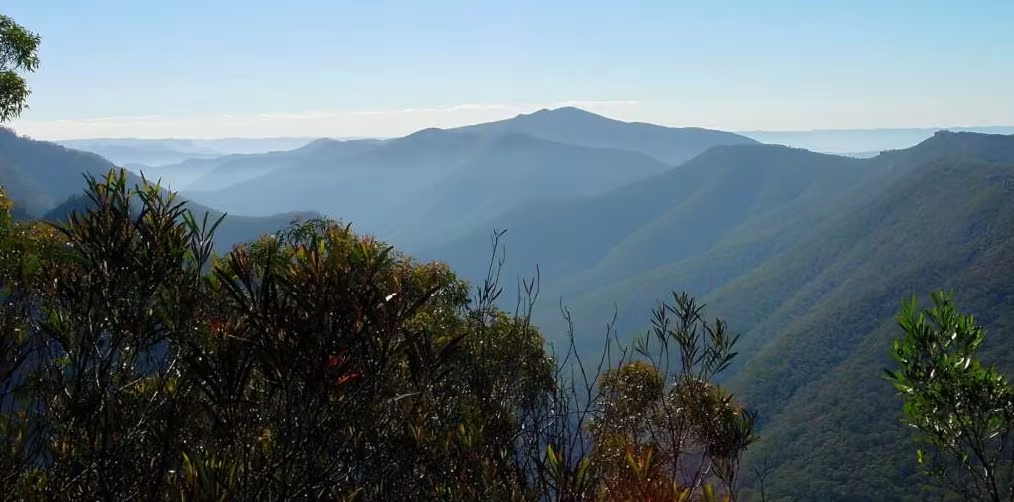
Another best hiking trail in the world is Kanangra to Katoomba Hike (K2K), Blue Mountains, NSW, which is in Australia. This trail covers a total distance of 45–52.5 km and takes travelers through the rugged terrains of Kanangra-Boyd and Blue Mountains National Park.
Most of the trails are located within the Blue Mountains National Park in New South Wales. The Kanangra to Katoomba stretch is a Grade 5 trail, which takes around 3 to 4 days to complete. So, it is best suited for experienced hikers with prior trekking experiences and navigation skills.
This route takes you through landmarks, such as Kanangra Walls, Mt. Cloudmaker (1,155 m), Coxs Rivers and the Tarros Ladders. The trails are highly impacted by fire regrowth and flood damage, which creates challenges in navigation. We recommend hikers carry topographic maps, GPS devices, and a Personal Locator Beacon (PLB).
The best times to go on the Kanangra to Katoomba Hike are during the months of Spring and Autumn. We do not encourage treks in the Summer months since the temperatures are over the head, and it also comes with fire risks.
Kakadu National Park Walk, NT

| Location | Northern Territory |
| Altitude | 2,381 feet |
| Level | Moderate |
| Distance | 42 miles/68km |
| Duration | 3-5 days |
Australia brings another best hiking trails in the world, which is Kakadu National Park Hike. It is a UNESCO World Heritage Site in Australia, which takes you through the remote landscapes featuring sandstone escarpments, rainforests, and wetlands rich in wildlife ecosystems.
Travelers can visit Aboriginal Rock Art Sites at Ubirr and Nourlangie. The paintings found in this site dates back to thousand years and it offers insights into the rich cultural heritage of the Bininj/Mungguy people.
You can also take the Barrk Marlam Walk, which challenges you with rugged terrains but treats you with rewarding views. You can also have the Anbangbang Billabong Walk which offers opportunities to experience diverse wildlife, birdlife, and serene water landscapes.
Some of the major attractions of the Kakadu National Park Hike include seasonal waterfalls like Jim Jim and Twin Falls. And the best time to visit these watersheds is during the months from May to October. The difficulty level of this hike is moderate to challenging, so we recommend travelers to visit with guides.
Overall, the hike summarizes Kakadu’s natural beauty and cultural significance, making it one of the best hiking trails in the world.
Popular Hiking Trails in America [South and North]
Kaieteur Falls Trek, Guyana

| Location | Guyana |
| Altitude | 226 metres (741 ft) |
| Level | Moderate |
| Duration | 3-4 days |
The Kaieteur Falls Trek in Guyana is an amazing hike that brings you to Guyana’s untouched rainforests. It offers you an opportunity to witness the pristine waterfall at Kaieteur Falls.
The Kaieteur Falls is 741 feet (226 meters) tall, making it the world’s tallest single-drop waterfall. The hike to the Kaieteur Falls hiking trail starts with a boat ride along the Potaro River. It passes through small waterfalls at first and reaches the boundary of the Kaieteur National Park, rich in natural biodiversity and ecosystems.
The trail then introduces you to the dense rainforest, which also includes navigating the steep ‘Oh My God’ Mountain. This is one of the major attractions of this hiking trail, which has earned its name from its challenging landscape. The climb takes you to the Kaieteur Plateau, which offers panoramic views of the surroundings.
The difficulty level of the Kaieteur Falls Trek in Guyana is moderate to challenging. The temperature and humidity play a vital role in your navigation, so you must be prepared with your trekking gear and plan. Besides hiking, travelers also can access this trail via chartered flights followed by a short hike.
Kaieteur Falls, the main attraction, is a pristine natural beauty, free from any outer world encroachment, making it one of the best hiking trails in the world.
The Salkantay Route to Machu Picchu, Peru

| Location | Peru |
| Altitude | 4,600 meters |
| Level | Challenging |
| Distance | 74 kilometers (46 miles) |
| Duration | 5 days |
If you are looking for something alternative to crowded trails, then The Salkantay Trek in Peru is the best option for you. This trek leads you through the diverse terrains to Machu Picchu, which covers a distance of approximately 74 kilometers (46 miles).
The hike through this trail starts in Mollepata, which is 100 miles away from Cusco, and it takes around 4 to 5 days to complete. During this phase, you will traverse through varied landscapes, including lakes, snowy mountains, and lush green forests. One of the key highlights of this hike is the climb to the Salkantay Pass at 4,630 meters (15,190 feet).
The Salkantay Trek does not require any permits so that you will have more flexibility and cost deduction. Also, you won’t have to worry about high traffic as you can expect an average number of 50 hikers per day in this area.
Major attractions include popular places such as Humantay Lake and Llactapata Inca Ruins. Here, you can see the beautiful view of Machu Picchu from the Inca Ruins.
The hike ends in Aguas Calientes after 3 to 4 days. Here, travelers can rest before exploring the iconic Inca citadel before concluding their beautiful experience.
Grand Canyon – United States
| Location | United States |
| Altitude | 2,074 m |
| Level | Moderate |
| Distance | 7.8 mile |
| Duration | 2-3 days |
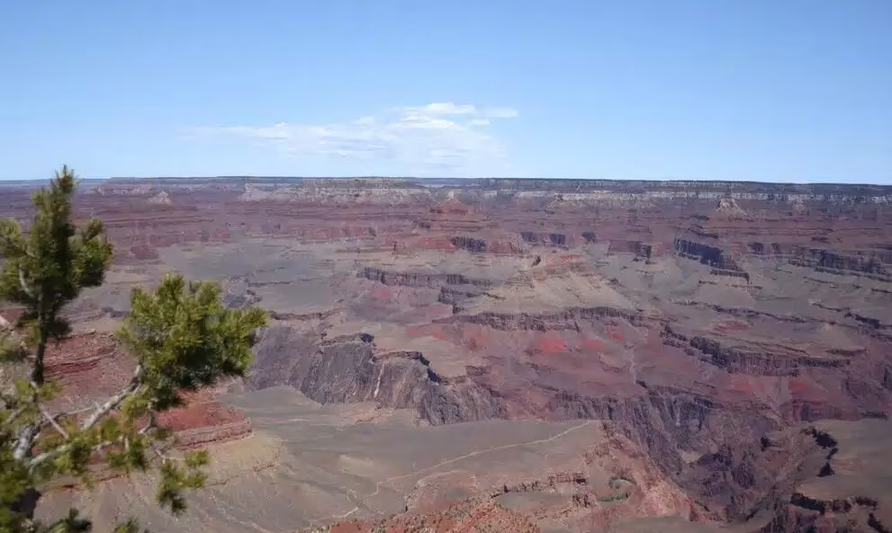
Anyone who is interested in nature hiking cannot ignore the hike to the Grand Canyon in Arizona. It is one of the best hiking trails in the world, which showcases the landscapes carved by the Colorado River for millions of years.
The North Rim trail for the Grand Canyon hike comes with a formidable challenge. This hiking route runs over the distance of 24 miles, starting at the North Kaibab Trail and ends at the Bright Angel Trail. Travelers traverse the downhill section for 6,000 feet and the uphill section for 4,500 feet, which is moderate to challenging in difficulty.
The South Rim trail for the Grand Canyon Hike is another trail to explore this natural wonder. The trail stretches from the village area to Hermits Rest, offering one of the best experiences during the journey.
The South Rim trail operates all year around and the North Rim opens up from mid-May to mid-October. But the best time to visit the Grand Canyon is Spring (April through mid-June), which comes with mild temperatures and calm weather.
The East Rim of the Grand Canyon is another trail to explore this beautiful place. It serves you with beautiful places like Horseshoe Bend or Antelope Canyon. This section lies within the Glen Canyon National Recreation Area, offering you the best experiences in life.
The Grand Canyon West Rim is the closest trail from Las Vegas. AAnd the major attraction of this section is Skywalk, which is a viewpoint with glass floor.
Yosemite National Park Hike – United States

| Location | United States |
| Level | Moderate |
| Distance | 0.8 km – 26.2 km |
| Duration | 2-3 days |
Yosemite National Park in California offers some of the best hiking trails in the world, ranging from gentle walks to challenging climbs. This is the most popular destination to visit in North America, catering a well-maintained trails suited for trekkers of all skill levels.
If you are looking for a family tour, then the Bridalveil Fall Trail is the best option. It is a 0.5-mile round trip that takes you to some of the stunning waterfalls in the national park. Another one is the Lower Yosemite Fall Trail, which is a 1-mile loop with not much elevation gain. It also offers easy access to the pristine waterfalls.
If you want to have panoramic views of Yosemite Valley, the Cook’s Meadow Loop 1-mile loop is the best option. The intermediate hikers find the Mirror Lake Loop the best-suited trail, which is a 5-mile loop. Another accessible route is the Valley Loop Trail, which spans 13 miles in distance.
For adventurous hikes, the Yosemite Falls Trail is the ideal option. It is a 7.2-mile long round trip that takes you 2,700 feet to the top of the falls. The next one is the Half Dome Trail, which is a 16.4-mile round trip. It is a challenging hike, taking you to 4,800 feet above sea level.
The best time to visit Yosemite National Park is during June or September. During these months, the temperature ranges from 70°F and 80°F and comes with clear views of the surroundings.
